| Cemetery Description: |
Bobr Jewish Cemetery, End of Gornaya street, Bobr, BELARUS, 291 burials total.
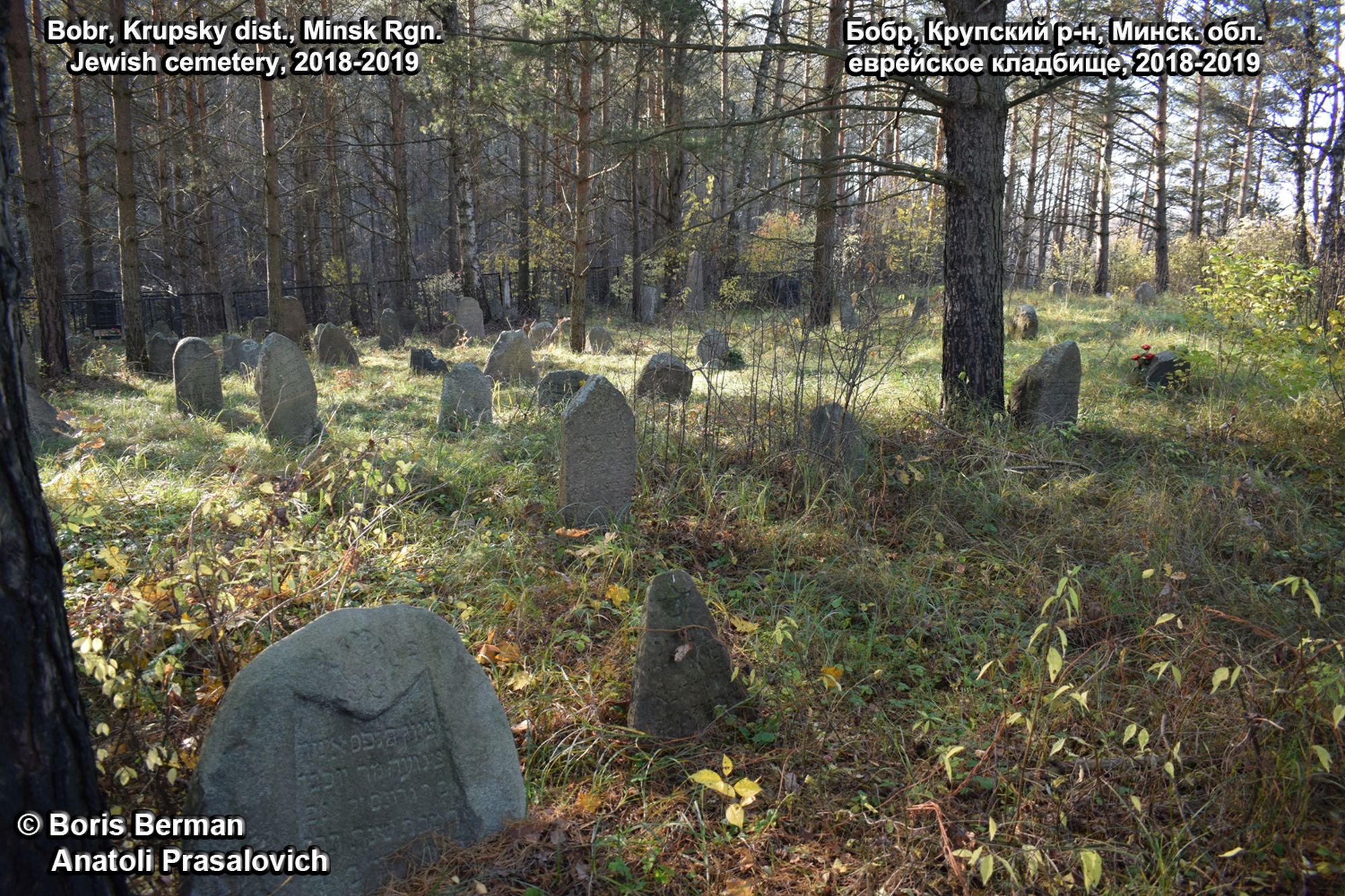
A total photographing of the Jewish cemetery in the shtetl of Bobr, Krupskiy district, was made from June 2018 to October 2019. Total of 277 matzevot were took pictures of at the Jewish cemetery in Bobr.
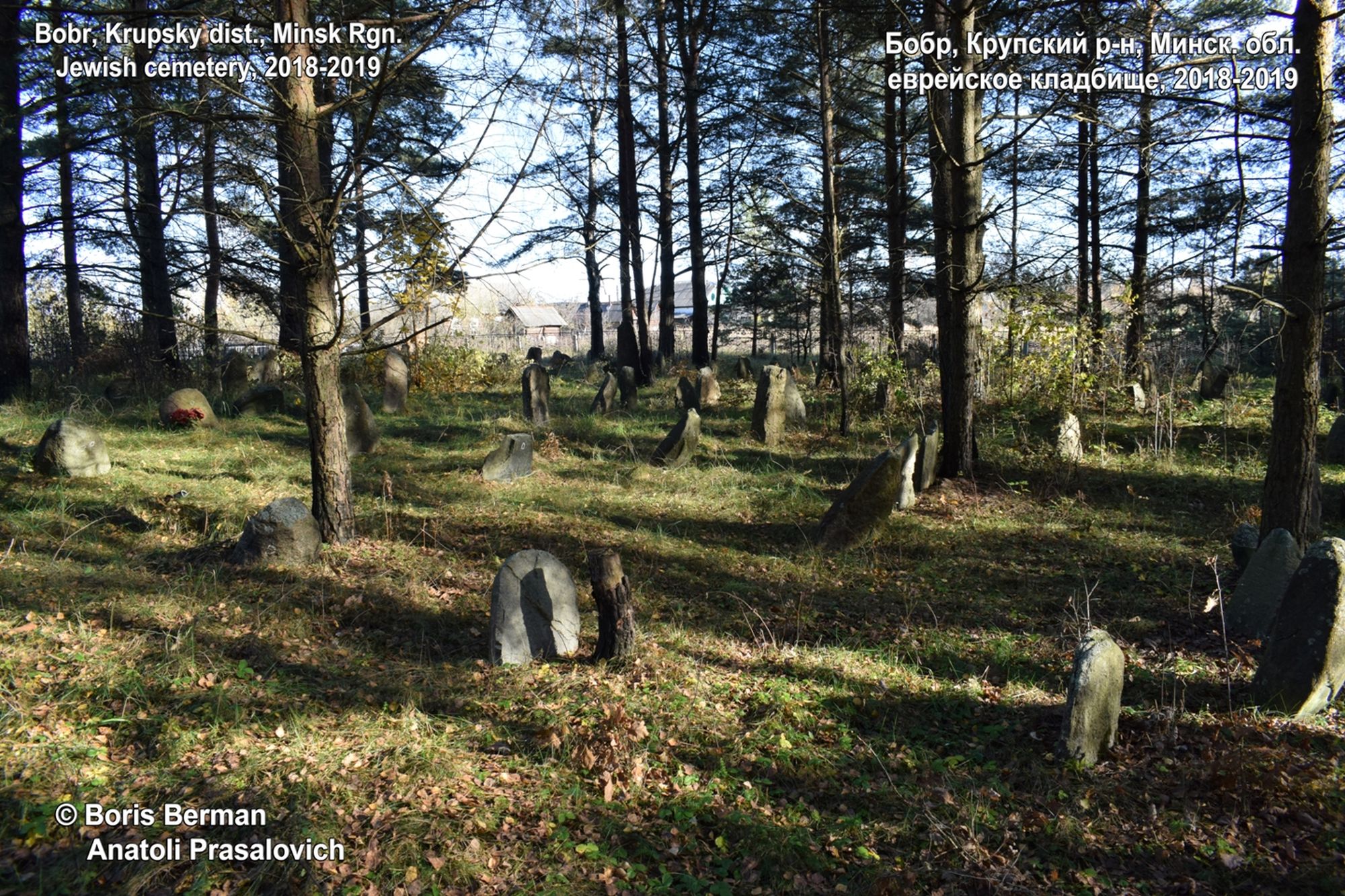
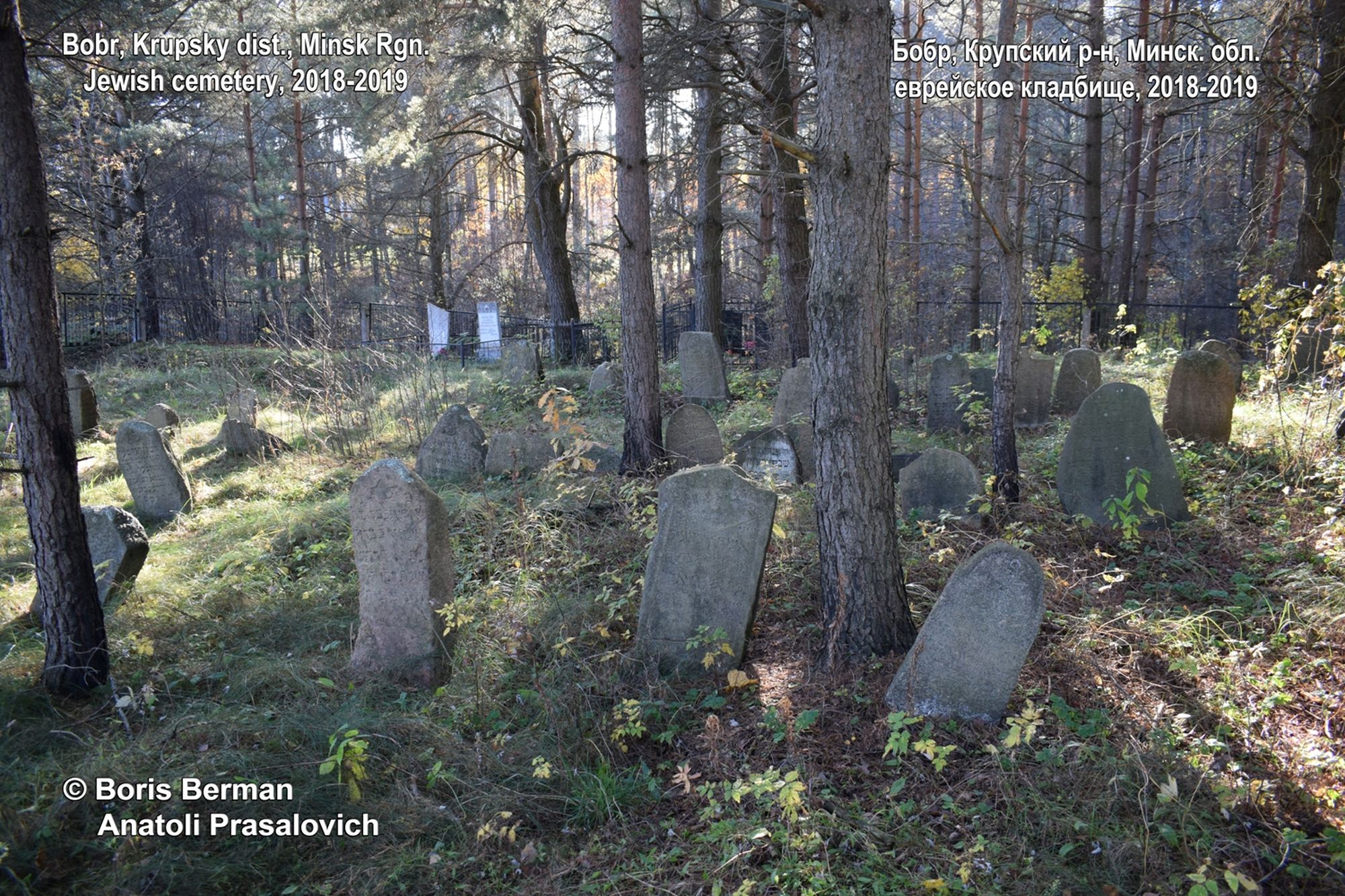
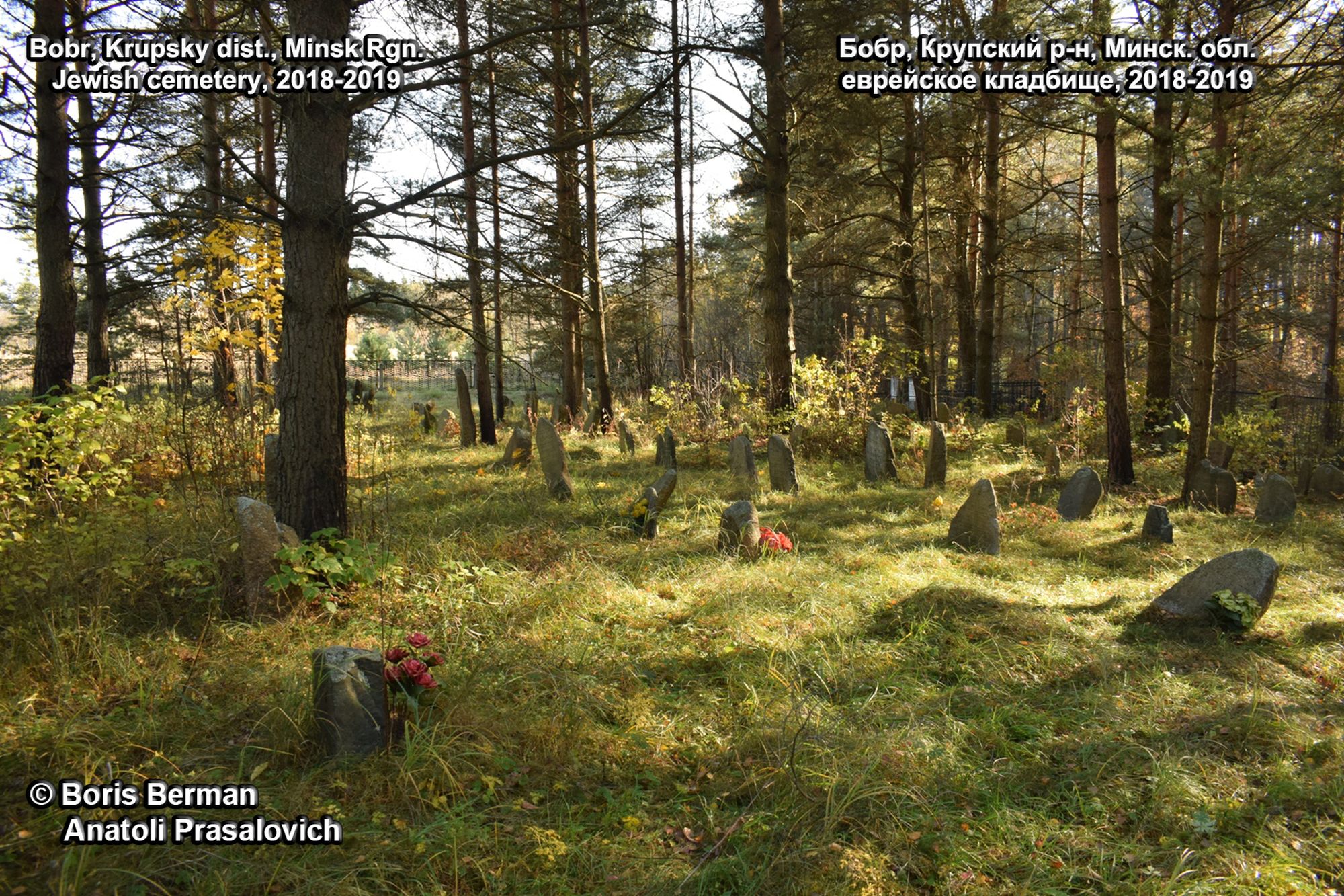
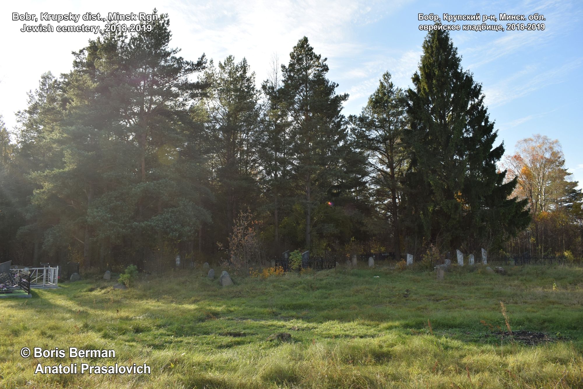
The cemetery is located on the southwestern outskirts of the village of Bobr, 300 meters north of the P19 highway, 2.5 km north of the railway Bobr-station, on the left bank of the Bobr river, by the end of Gornaya street. The cemetery is fenced off with a metal fence, the inscriptions on the stones and monuments are directed to the NE. The eastern part of the cemetery located closer to the street is open, there are no gravestones in this part, with the exception of 3 half-broken matzevot in the middle of this open space, clearly transferred here from another place.
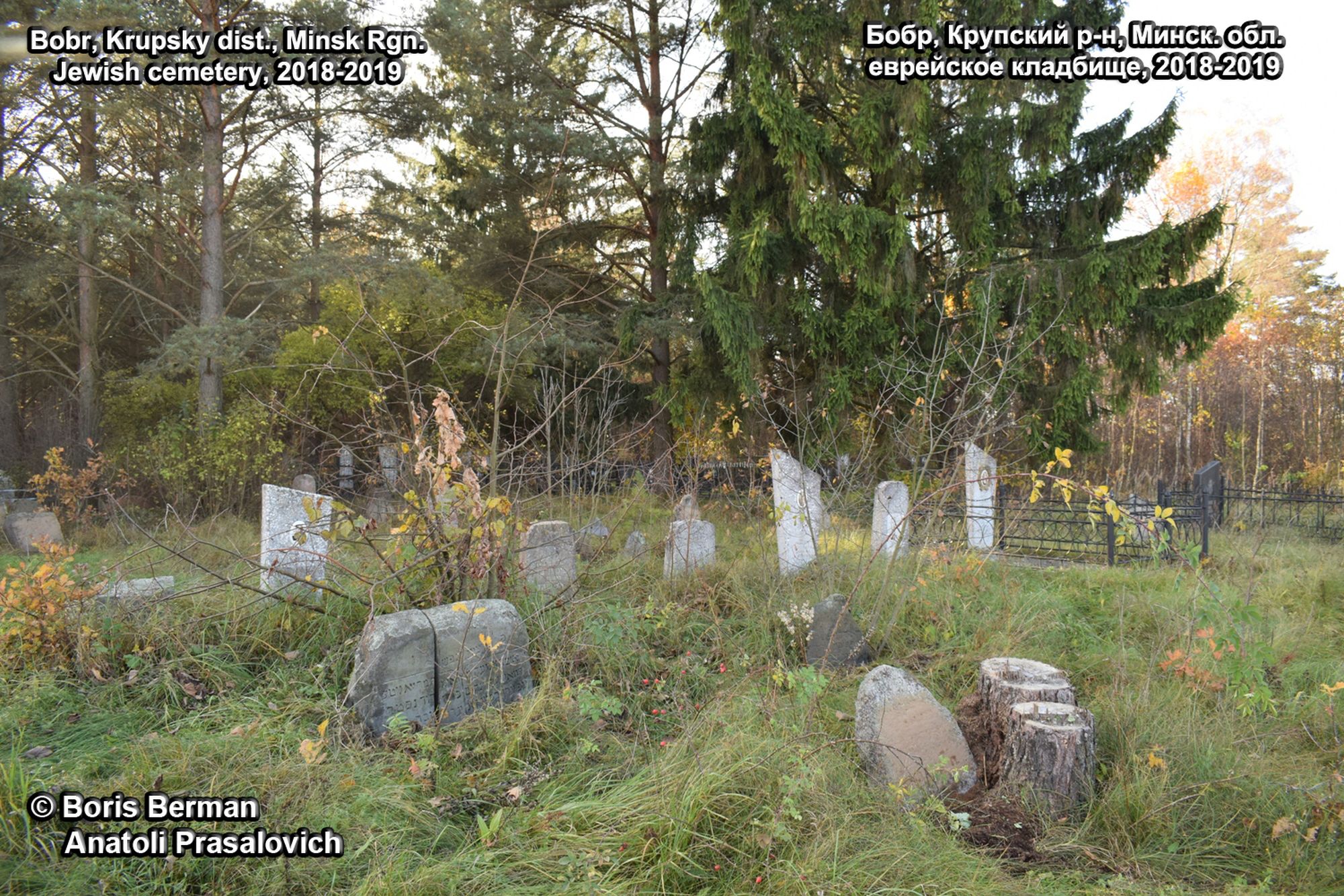
In the center of the cemetery there are modern monuments of the XX-XXI centuries, old stones are located in the western part, they go in almost regular rows. There are about 8 rows in total. The cemetery is well-groomed, the bushes are hewn, the rubbish is removed. The preservation of the inscriptions on the matzevot is good and satisfactory. At the same time, the western part is also little overgrown with forest: there are only old tall pines, due to which the stones are slowly covered with a layer of fallen leaves. The northern part of the fenced-in area is overgrown with young birch forests, in which only a few gravestones were found. Fallen inscription down matzevot are very few.
The coordinates of the cemetery: 54.3377253,29.2663438
Bobr Jewish Cemetery - Link on Google Maps https://www.google.by/maps/place/54%C2%B020'15.8%22N+29%C2%B015'58.8%22E/@54.3377863,29.2653622,232m/data=!3m1!1e3!4m5!3m4!1s0x0:0x0!8m2!3d54.3377253!4d29.2663438
(54°20'15.8""N 29°15'58.8""E)
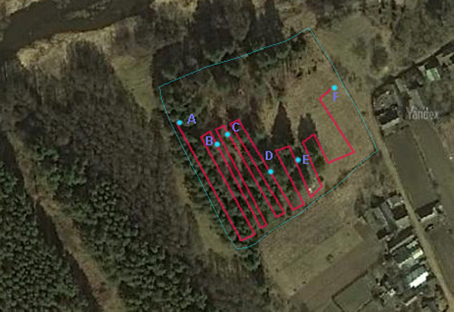
The map of the cemetery (Bobr_2018-2019-ab.jpg) has letters to mark trace of taking photographs, according to catalog numbers.
1 - A-B (matsevot 001-068)
2 - B-C (matsevot 069-136)
3 - C-D (matsevot 138-189)
4 - D-E (matsevot 190-242)
5 - E-F (matsevot 244-279)
Surnames, read from matzevot: Ratnitsky, Segal, Erusalimchik, Rozenblum, Zusin, Lukomski, Gelman, Rotshild, Gendel, Genzer, Shtukmaster , Manevich, Kirshenbaum, Shulman, Klebanov, Valshtein, Alshits, Shatsauz, Mazo haKoen, Shenderovich, Pekler, Kazelovich, Shabatupazin, Shenderov, Zalman, Fridlyander, Sirotkin, Lupkin, Shmukler, Ziskind, Goldin, Gorodinski, Levin, Pevzner, Hazai ?, Fibesh, Kaganov, Gitlevich, Kats, Tsiporkin, Honin, Ivanovich, Kaiovskaya
Data submitted courtesy of BORIS BERMAN (initiative, organization, funding, Photoshop processing, translation).
Pictures taking – Anatoli Prasalovich.
Hebrew reading and translation: Mordehai Motola, Arie Parnis.
Map of cemetery
|


