Maps Gallery
Maps are very useful tools that can provide informative context to genealogical research. They can be used to better understand the localities in which our ancestors lived and their movement between towns. Maps also enable us to understand the impact of changing geopolitical borders over time. Even if your ancestors resided in the same town over many years, that town may have belonged to different countries during that time. Understanding this provides insights into where genealogical records may be found for your ancestors.
In order to effectively use maps in your research, you must first identify the town in which your ancestors lived. Below are some informative resources to help you.
These maps depict Ukrainian territory over time. Click on any small image to see a full-sized view. The larger view will open in a new window or new tab. You can then right-click on that larger image to save it to your computer.
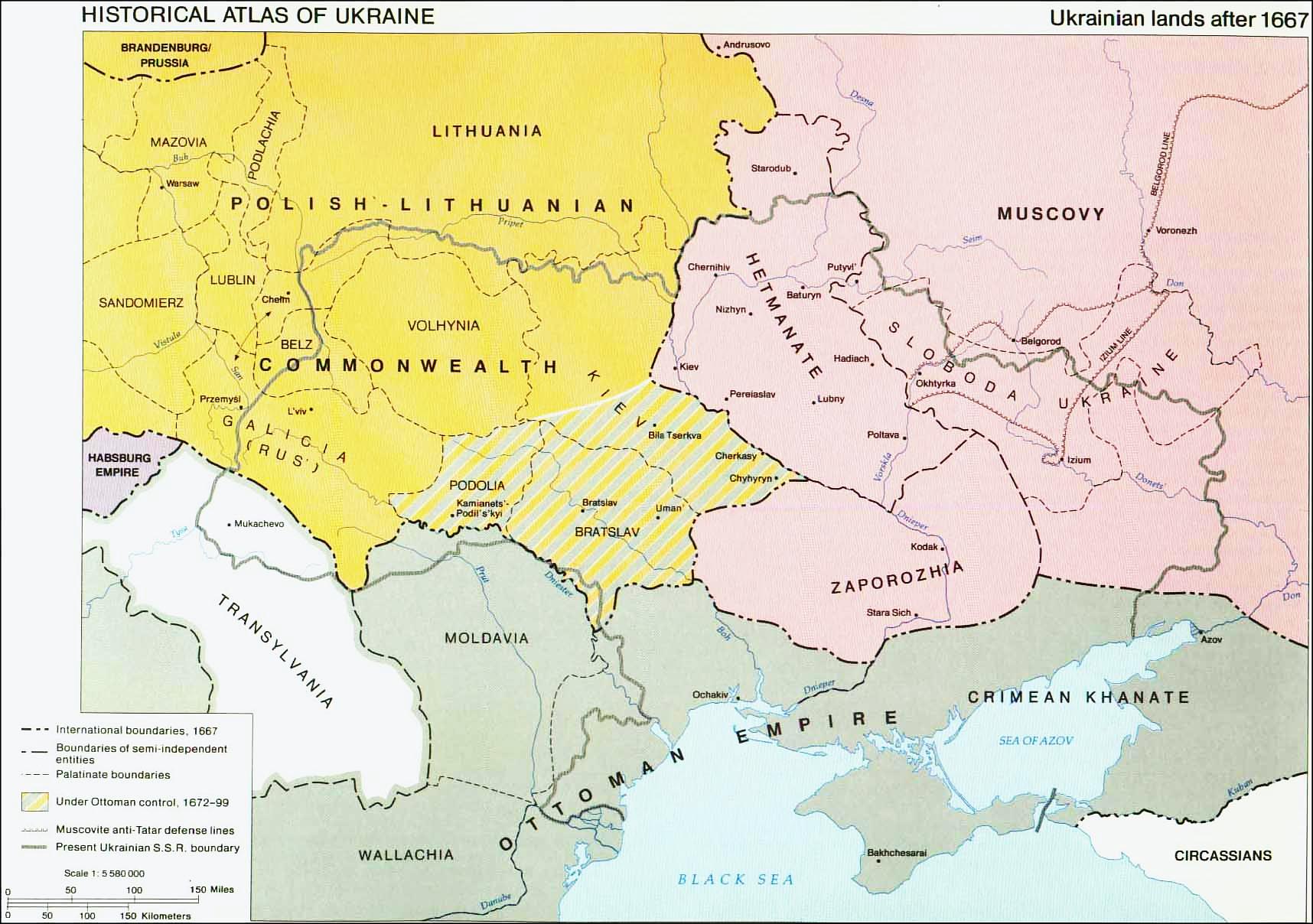
1. Ukrainian Lands after 1667
|
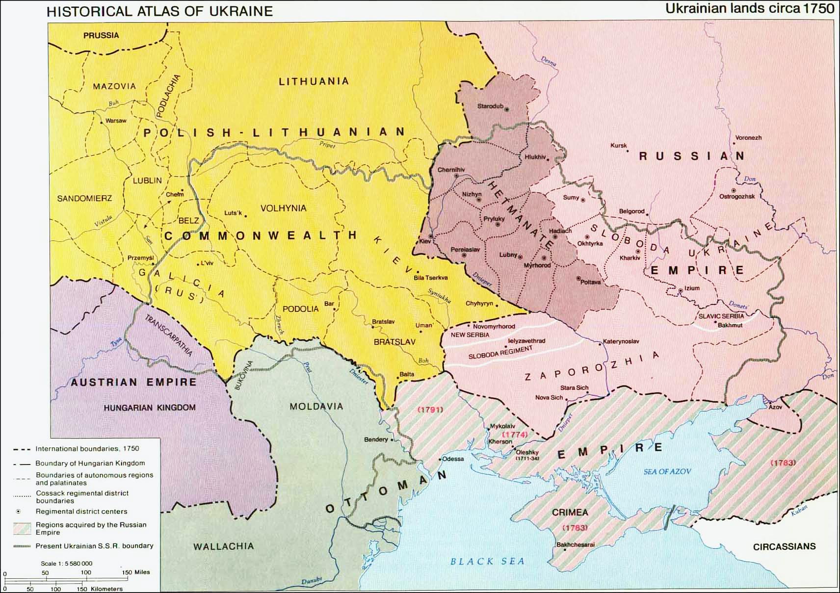
2. Ukrainian Land circa 1750
|
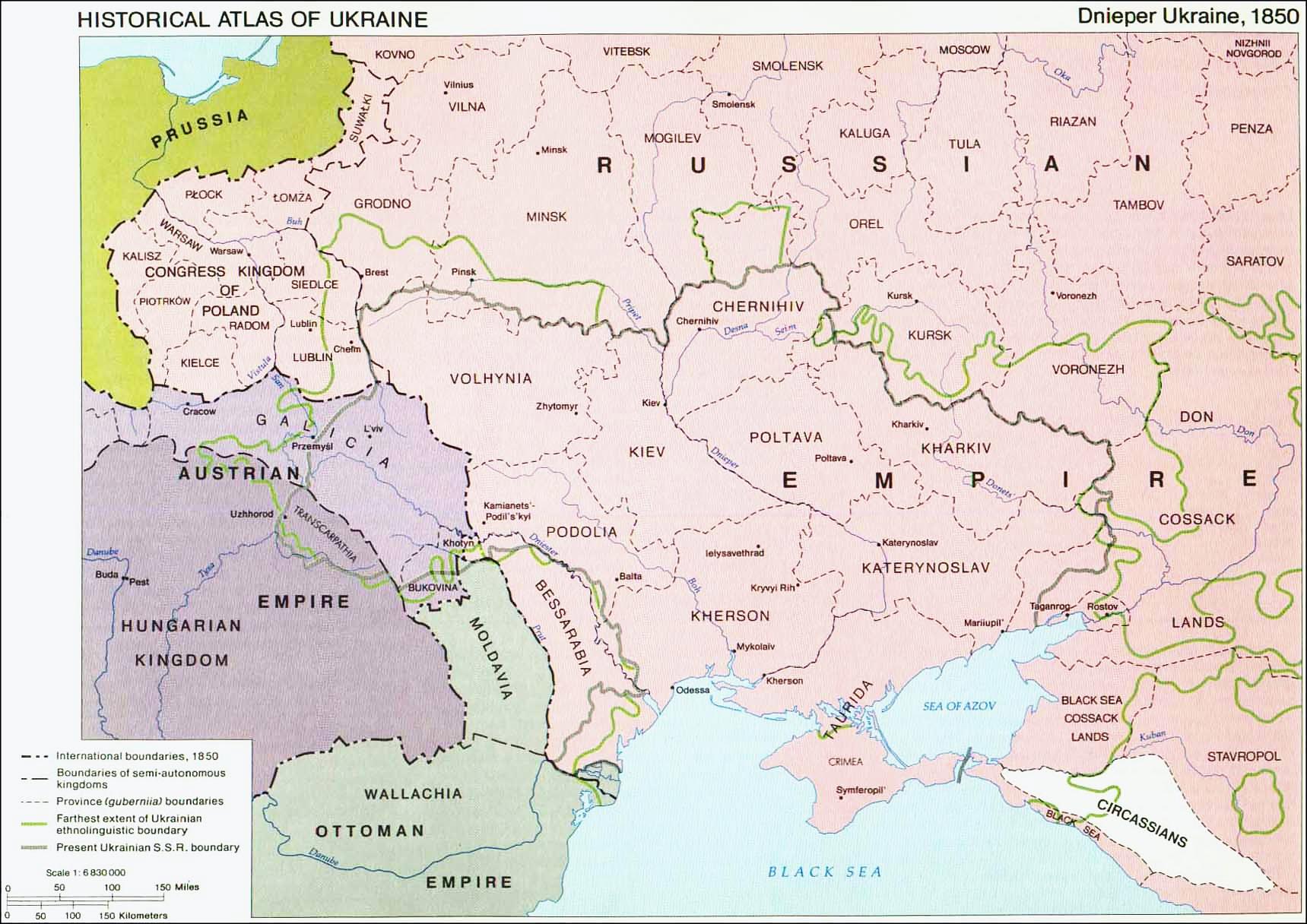
3. Ukrainian Land 1850
|
|
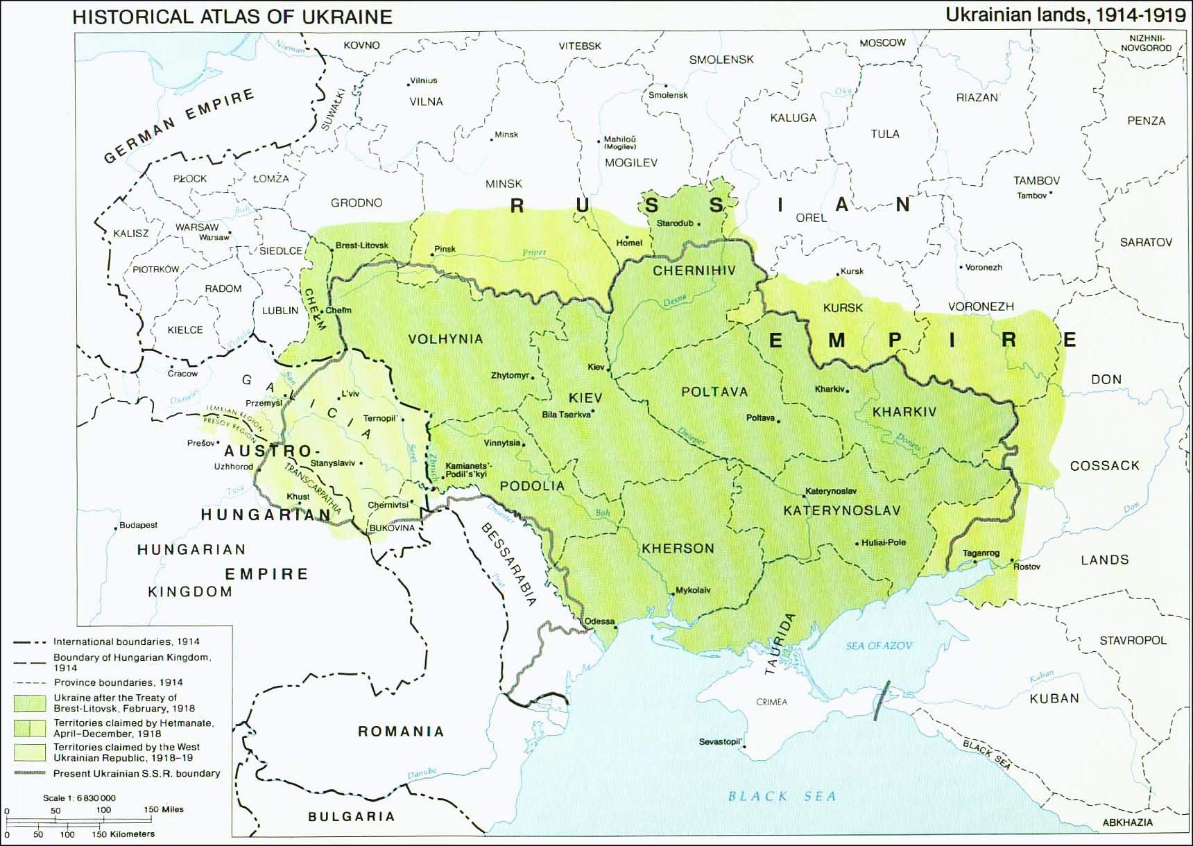
4. Ukraine 1914-1919
|
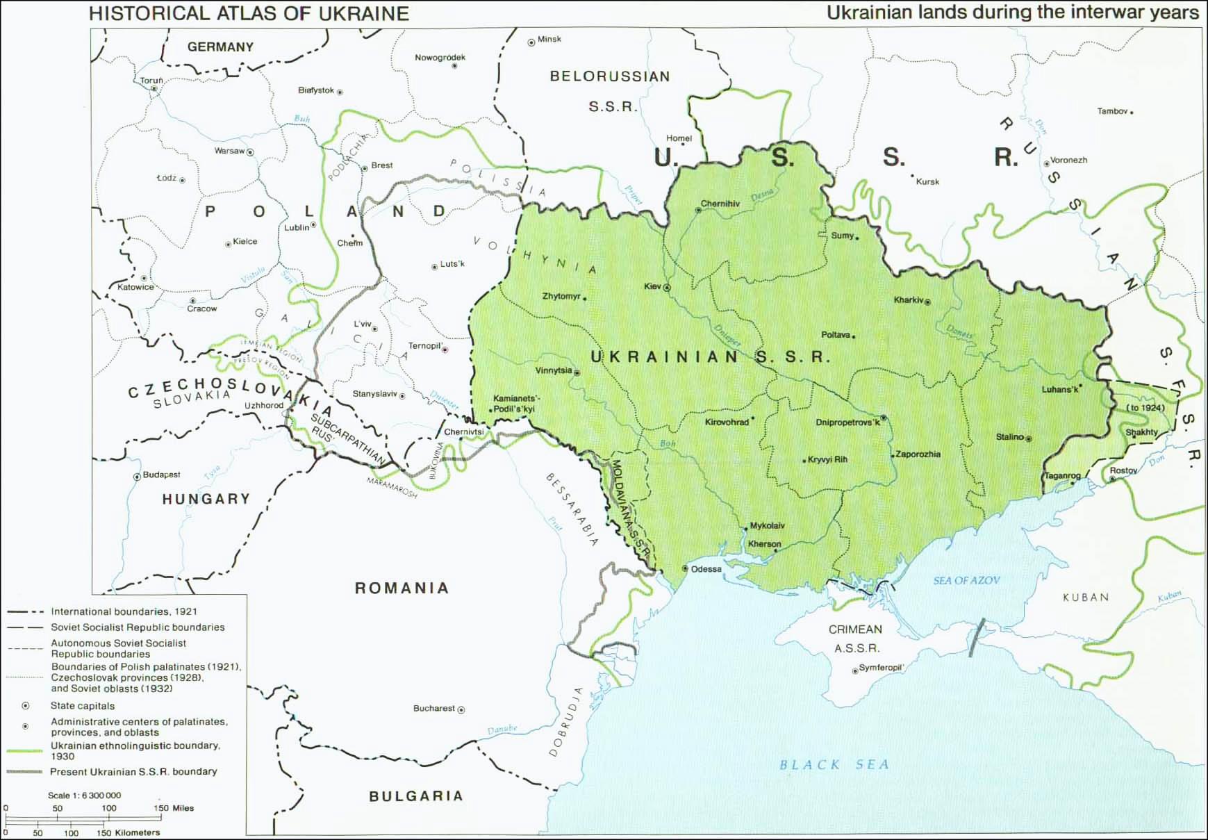
5. Ukraine between WW1 and WWII
|
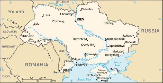
6. Ukraine 2003
|
For links to other maps please go to the Maps & Gazetteers section on our links page.
If you have other maps (older than the 72-year copyright, of course) or map links you'd like to share, please contact us.