13. Map 1918 - After WWI
 |
|
|
|
|
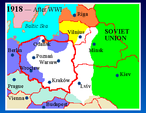
Map Key: Red Lines = Modern borders White = Poland Green = U.S.S.R. Blue = Germany Yellow = Lithuania Pale Green = Czechoslovakia Tan = Romania |
After World War I, the nations of the world met for the Treaty of Versailles in 1918. The nation of Poland was reborn, after more than 120 years. The Second Republic of Poland was about 60% of the size of pre-partition Poland. These borders lasted from 1918 until 1939.
Inter-war Poland's territory includes Vilna, Grodno, and Volhynia gubernias from former Russian Empire; and nearly all of Galicia from the former Austrian Empire... areas that today are in Lithuania, Belarus, and Ukraine. To the south, the Austrian Empire is gone, replaced by the newly-formed nation of Czechoslovakia.