Detailed Town Maps
(click each map to enlarge)
|
|
 |
|
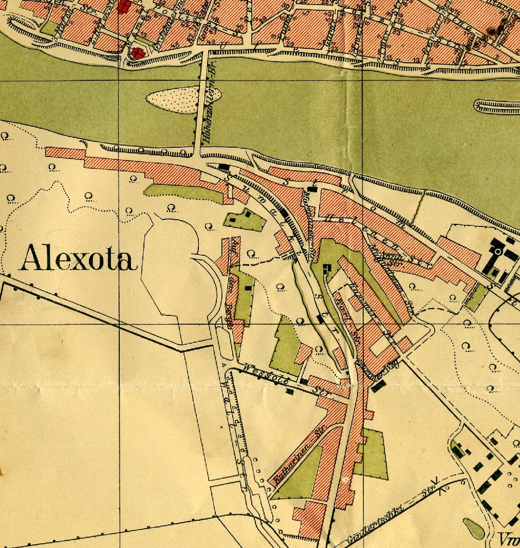
Aleksota German map, 1:10K scale, 1916. Kowno (Kaunas) is across the Niemen River, at the top of the map. |
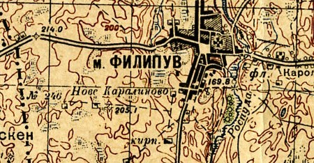
Filipow. Russian map from 1941. The border with Germany is shown on the left 1:50K [no enlargement available] |
|
|
|
|
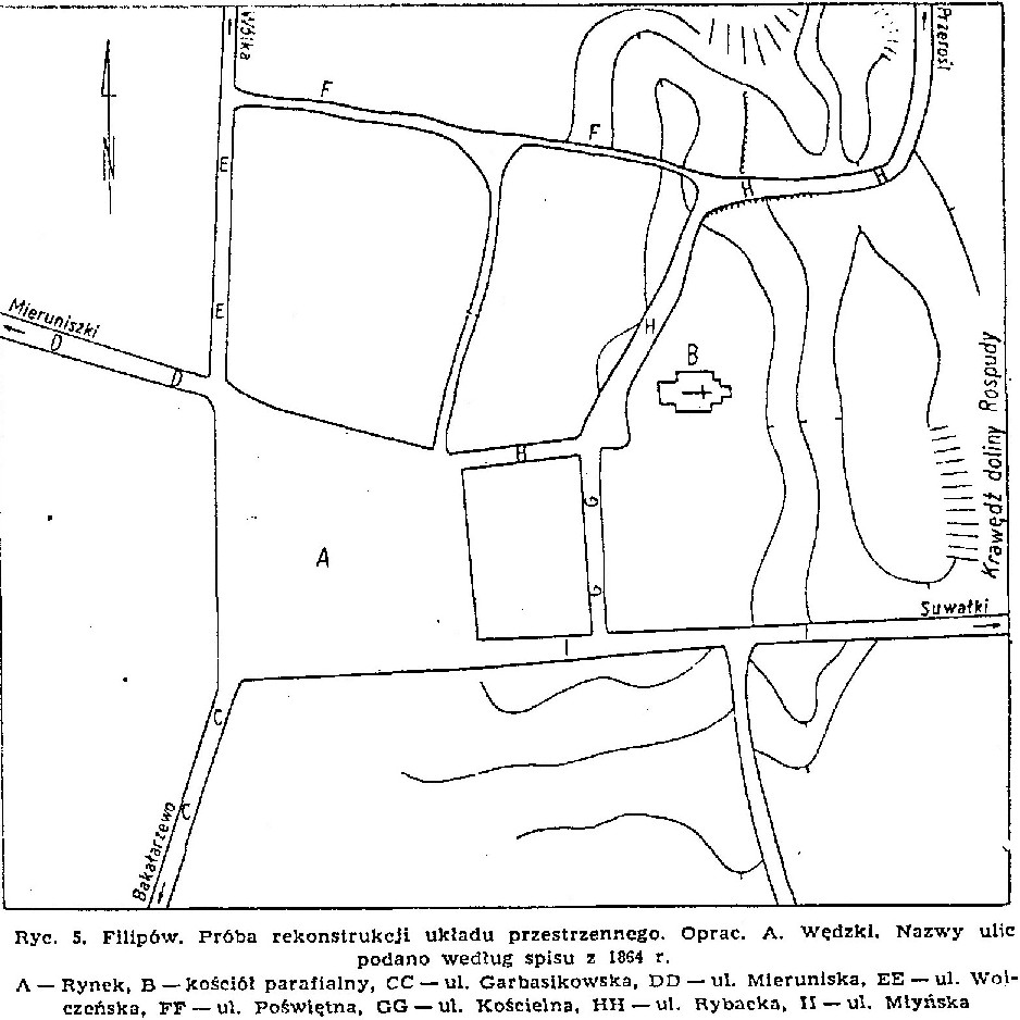
Filipow city plan from 1864. The translation of the coded key is: A. Rynek = Townhall; B. Kosciol parafialny = Parish church; all the others, ul. is an abbreviation for ulica = street. |
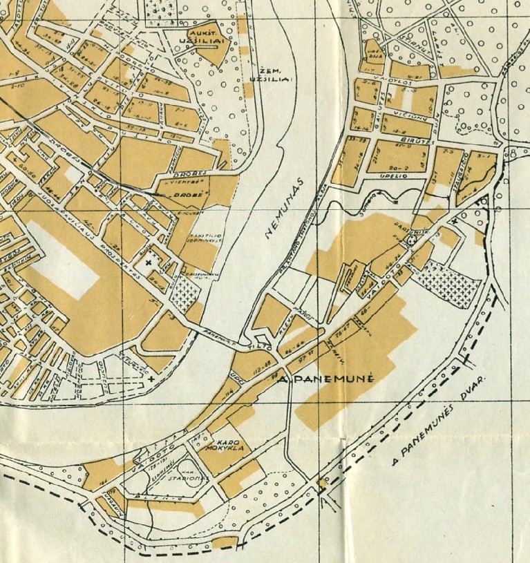
Panemune Lithuanian map from 1935. Scale is 1:20K. Kowno (Kaunas) is across the Neimen River on the left. The map came from the book "Vadovas Po Kauna Ir Apylinkes". |
|
|
|
|
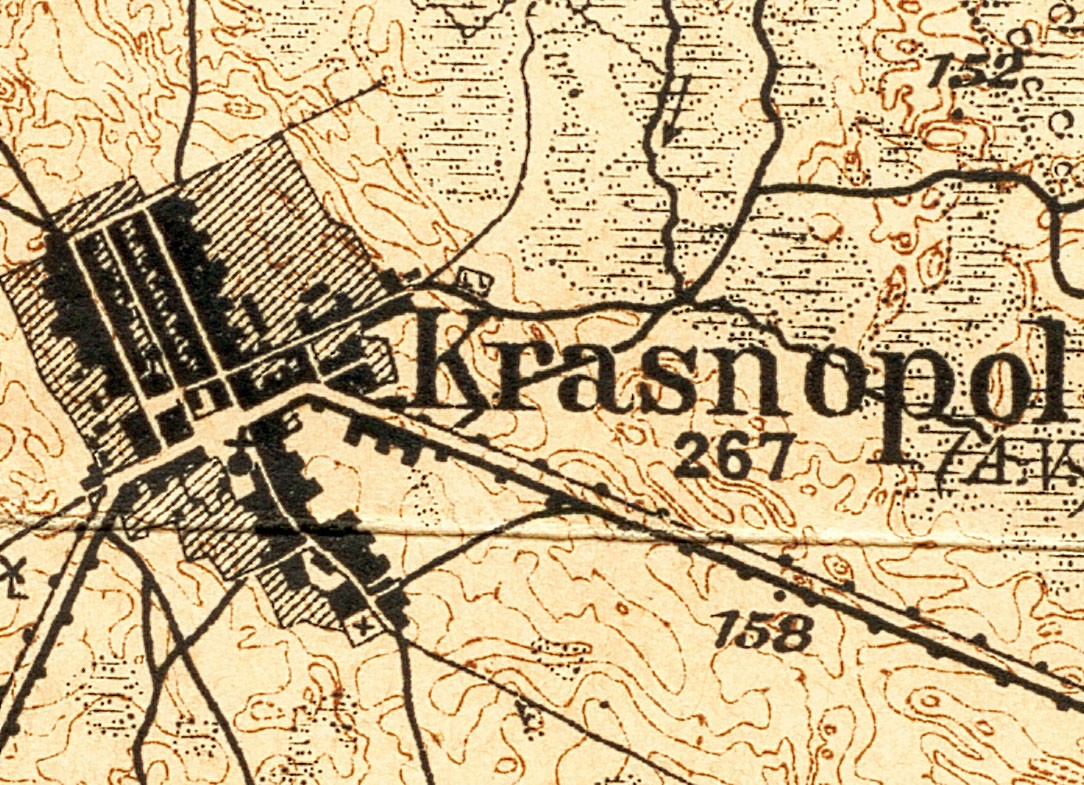
Krasnopol |
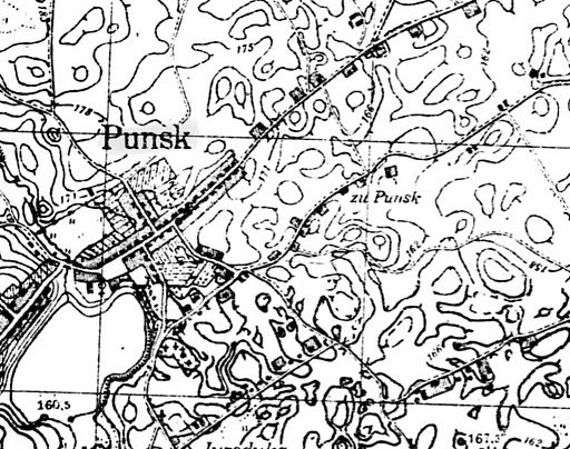
Punsk German map, 1:25K scale, 1944. |
Back to Maps from The Suwalk-Lomza Region