| ... |
use
your "Back" button to return from a map -
Additional Map Sites
www.mapy.cz (in Czech only) - search for maps of the Czech Republic, includes statistical data for cities such as total population (Obyvatel celkem)
and cadastral area (Katastrální výmera), enter city name in box and click on "hledej"
JewishGen Shtetl Seeker - Search for towns in Central and Eastern Europe, using exact spelling or the Daitch-Mokotoff Soundex system
Federation of East European History Societies Map Room
Maporama - maps and driving directions for Europe
Map24 - Interactive map of Europe, which allows zooming and roaming
Locality Finding Aids
Register of Localities under Research (at the Jewish Museum in Prague) - includes:
- Official names of communities used today along with the German, Polish and Czech historical forms of local names
- Administrative division for each community (as of 2000)
- Additional symbols, indicating the sites of religious communities or other towns of historical Jewish significance
Staatliche Verwaltungseinheiten der Regionen im Staate Böhmen und in dessen Nachfolgestaaten
(Governmental Administrative Districts of the Regions in the State of Bohemia and its Successor States) (German)
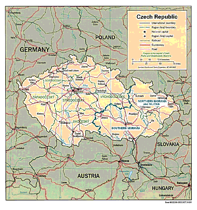
-Maps and information regarding the historical Kreis divisions in Bohemia, Moravia and Silesia
- Liste G - shows the changing number and names of the Bohemian Kreise from 1350 to 1862
- Liste L - shows the Kreis names for Moravia from 1529 - 1860
- Liste M - contains details of the Silesian Kreis names
Amtliches Deutsches Ortsbuch für das Protektorat Böhmen und Mähren
(Official German Location Book for the Protectorate of Bohemia and Moravia)
- Organized by 1940 county (Kreis) designations
- Allows for conversion of German place names into their Czech equivalents
Return to Austria-Czech SIG Homepage
|
... |
