14. Map 1945 - After WWII
 |
|
|
|
|
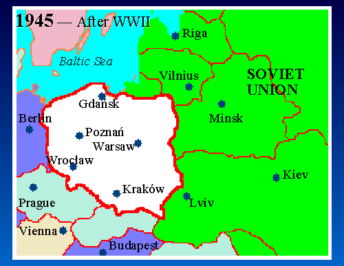
Map Key: Red Lines = Modern borders White = Poland Green = U.S.S.R. Blue = Germany Pale Green = Czechoslovakia |
After World War II (1945), the borders of Poland all shift west. The Russians won the war; the Germans lost -- so parts of eastern Germany became part of Poland (East & West Prussia, Pomerania, Silesia), and the Soviet Union took over the eastern provinces of inter-war Poland (Wilno, Nowogrˇdek, Polesie, Wolyn, Tarnopol, Lwˇw, Stanislawˇw).